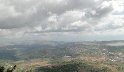
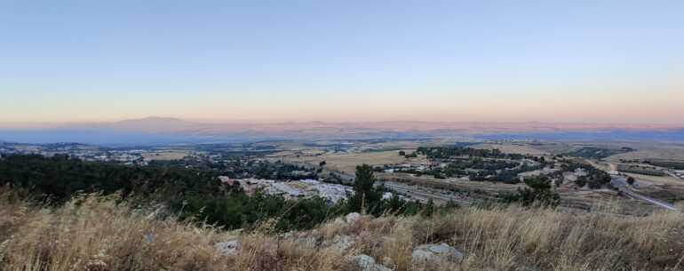
1208 meters above sea level, Mount Meron is one of Israel’s tallest mountains. On my family tour to northern Israel, we stayed an over-night in the area, and woke up the next day to an unbelievably gorgeous weather and one of Israel’s finest views topped with a fine delicate cream of clouds hovering above. On a truly clear day, you can far into Lebanon and the Golan Heights, perhaps as far as Syria.
Absolutely breath-taking.
The hike surrounding the army base on the top of the mountain, is part of the Israeli National Trail, covering Israel from the north to the south. This short part of Mount Meron took us less than two hours.


You gotta love the north.
Wikipedia offers a nice politically correct map with the exact location:


i enjoy all your post about Israel , even the ones which i don't comment.
It's a beautiful moiuntain one of my favorite hiking spots in Israel.
I went there form the north the east and from the south 700~ meters ascend.
In the southern peaks (near Hillel and Ha-Ari peaks) there are some point of view
which you can see the see of Galilee after some hiking.
Thanks, Nitzan, that's always nice to hear.
I have lots more photos from my recent adventures there. Will hopefully post those later.